


Craig Smith Comm Center, Talladega County, Alabama
About
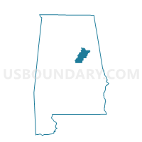
Outline

Summary
| Unique Area Identifier | 522947 |
| Name | Craig Smith Comm Center |
| County | Talladega County |
| State | Alabama |
| Area (square miles) | 44.23 |
| Land Area (square miles) | 43.71 |
| Water Area (square miles) | 0.52 |
| % of Land Area | 98.82 |
| % of Water Area | 1.18 |
| Latitude of the Internal Point | 33.16310980 |
| Longtitude of the Internal Point | -86.23110860 |
Maps


Graphs
Select a template below for downloading or customizing gragh for Craig Smith Comm Center, Talladega County, Alabama


Neighbors
Neighoring Voting District (by Name) Neighboring Voting District on the Map
- Fayettville -Co Line, Talladega County, AL
- Hollins Community Center, Clay County, AL
- Limbaugh Comm Center-Bon Air- Oak Grove, Talladega County, AL
- Pct. 1205 West Coosa Senior Center, Coosa County, AL
- Pct. 1216 West Coosa Senior Center, Coosa County, AL
- Pct. 1224 West Coosa Senior Center, Coosa County, AL
- Sycamore Nutrition, Talladega County, AL
- Tri-Community Fire Dept., Clay County, AL
- Winterboro Vol Fire-Gable's Corner Vol Fire, Talladega County, AL
Top 10 Neighboring County Subdivision (by Population) Neighboring County Subdivision on the Map
- Sylacauga CCD, Talladega County, AL (22,123)
- Childersburg CCD, Talladega County, AL (9,064)
- Sycamore-Winterboro CCD, Talladega County, AL (4,742)
- Weogufka-Marble Valley CCD, Coosa County, AL (3,927)
- Millerville-Hollins CCD, Clay County, AL (2,480)
Top 10 Neighboring Place (by Population) Neighboring Place on the Map
- Sylacauga city, AL (12,749)
- Stewartville CDP, AL (1,767)
- Mignon CDP, AL (1,284)
- Hollins CDP, AL (545)
- Oak Grove town, AL (528)
Top 10 Neighboring Unified School District (by Population) Neighboring Unified School District on the Map
- Talladega County School District, AL (49,716)
- Clay County School District, AL (13,932)
- Sylacauga City School District, AL (12,749)
- Coosa County School District, AL (11,539)
Top 10 Neighboring State Legislative District Lower Chamber (by Population) Neighboring State Legislative District Lower Chamber on the Map
- State House District 35, AL (44,612)
- State House District 37, AL (43,958)
- State House District 33, AL (43,809)
Top 10 Neighboring State Legislative District Upper Chamber (by Population) Neighboring State Legislative District Upper Chamber on the Map
Top 10 Neighboring 111th Congressional District (by Population) Neighboring 111th Congressional District on the Map
Top 10 Neighboring Census Tract (by Population) Neighboring Census Tract on the Map
- Census Tract 115, Talladega County, AL (5,591)
- Census Tract 116, Talladega County, AL (4,857)
- Census Tract 111, Talladega County, AL (4,742)
- Census Tract 117, Talladega County, AL (4,308)
- Census Tract 9611, Coosa County, AL (3,927)
- Census Tract 119, Talladega County, AL (2,948)
- Census Tract 114, Talladega County, AL (2,873)
- Census Tract 9592, Clay County, AL (2,480)
- Census Tract 118, Talladega County, AL (2,216)
- Census Tract 120, Talladega County, AL (2,203)
Top 10 Neighboring 5-Digit ZIP Code Tabulation Area (by Population) Neighboring 5-Digit ZIP Code Tabulation Area on the Map
- 35160, AL (26,822)
- 35150, AL (18,472)
- 35151, AL (7,632)
- 35072, AL (5,193)
- 35014, AL (4,546)
- 35149, AL (630)
- 35082, AL (7)